Red Rock Scenic Byway
Explore the sculptural beauty and colors of the Colorado Plateau
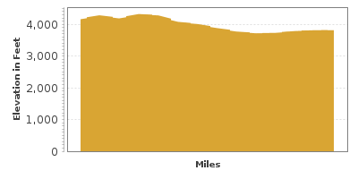
| Mileage | 14 miles (22 km) |
|---|---|
| DurationThe duration is an estimate of a one-way drive and does not include any stops or side-trips. | 20 minutes |
| SeasonsThe seasons listed are the best seasons for this scenic drive. If Winter is not mentioned, the road may be closed during the winter. | Spring, Summer, and Fall |
| Roadways | Arizona Highway 179 |
| PassesSome of the adventures on this scenic drive require an admission fee that these passes cover. Please read the drive description for more information. | Red Rock Pass for Coconino National Forest (Arizona) |
| ServicesThe cities or towns listed have either Food or Services such as gas, pharmacies, etc. | Munds Park, AZ▼, Sedona, AZ▼, McGuireville, AZ▼, Rimrock, AZ▼, Lake Montezuma, AZ▼, and Camp Verde, AZ▼ |
| Rating | 3.7 average from 40 votes |
| My DrivesTrack your favorite scenic drives by selecting those which you want to take and those that you have taken. Using your free account, simply sign in and select My Drives. | |
| Share |
Our free Road Trip Planner will reverse the route and include the places of interests. Click the “Add to Road Trip” above to start planning your next road trip.
Send this link to your phone. Standard text messaging rates apply.
() -Get directions from your start address to the beginning of and including this scenic drive. Choose either an alternate ending or same as start.
Have more destinations? Use our free Road Trip Planner to completely plan your adventure. Click the “Add to Road Trip” above to start planning your next road trip.

Get a Park Pass
Natural areas along this route require an entrance fee used to protect and maintain our most scenic treasures. Save time by purchasing your forest passes before you go.
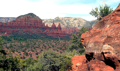
The Red Rock Scenic Byway begins in the town of Sedona, on the southwest edge of the Colorado Plateau, the largest plateau in the United States. Revel in the beauty of its iron-infused red rocks and fascinating geological features, including hoodoos, natural bridges and canyons. This short drive is packed with adventure — from hiking, biking, golfing and the sheer majesty of the scenery.

Begin in Sedona, which can be reached from US-89A from Flagstaff and I-40/I-17. From Sedona, head south on AZ-179.
In 3 miles, turn left onto Chapel Road and visit the Chapel of the Holy Cross (A1), one of Sedona’s most magnificent man-made structures. Built into the red rock mesas, the Chapel is open to all faiths. Cathedral Rock rises a few miles to the southwest of the building and the chapel offers a spectacular view. The layered cliffs of Cathedral Rock were created by millions of years of deposited sediment carved by the forces of nature. It is one of the most photographed landscapes in Arizona.
Back on AZ-179, for about a mile is the Little Horse Trail (H1). This easy, 3-mile round trip hike offers the opportunity to explore not only the amazing rock formations in this area, but a diverse array of plant life. The path also features shady spots under the dwarfed and gnarled trees. Leaving from here as well, is Bell Rock Pathway (H2). Along this 3.6-mile trail, enjoy views of Bell Rock, Courthouse Butte, and many other rock formations. The trail is fairly easy, with a few steep and rough areas. Note you will need a Red Rock Pass or an America the Beautiful Pass to park at the many trailheads. This area is also fast becoming a mountain bike mecca and you’ll meet many bikers along some routes. Bike rentals are available nearby. Or if golfing is your game, the byway features two public golf courses — with fabulous views.
Continuing south, the striking Bell Rock Butte dominates the view. Stop at Bell Rock Vista (V1) and have your camera ready. Sun blazing on red rock and blue skies create dramatic and exciting images. Many hiking and biking trails leave from here and this area is also a known vortex site — a sacred place where it is believed energy emanates from the earth permitting people to realize their dreams and ambitions.
Take Back O’ Beyond Road for Cathedral Rock. Don’t miss hiking this incredible rock formation. It is somewhat challenging, but easier than it looks — especially if you like to scramble over massive rocks. In contrast to the red rock, green cactus, yucca, sagebrush and brightly colored wildflowers dazzle. The short, steep climb to the top rewards with extraordinary views of this other-worldly landscape.
The drive comes to a close as you arrive in Oak Creek. The Village of Oak Creek features a variety of restaurants, art galleries, lodging and spas. From here, consider turning around and driving through the Oak Creek Canyon and continue north to the Grand Canyon.
Other Nearby Places of Interests
Red Rock State Park (H3): Red Rock State Park is one of the newest state parks and aims to maintain the park as natural as possible. Hundreds of bird species stop at Oak Creek. Explore the park through its network of trails, including the Eagle’s Nest and Smoke Trail.
Montezuma Castle National Monument (H4): Montezuma Castle National Monument offers access to the wonderfully preserved cliff-side homes built by the Sinagua people. Built over 1,000 years ago the Monument resembles an apartment building carved out of a cliff.
West Fork Trail (H5): Leaving from the Cave Springs Campground’s Call of the Canyons Day Use Area, the 3-mile West Fork Trail (H2) passes wildflower meadows frequented by hummingbirds and butterflies as it winds deep into the maze of canyons. Portions of the hike require you to walk through ankle-deep streams, so be prepared. Many other hikes leave from this area. Parking will require a Red Rock Pass
Schnebly Hill Road (T1): Traveling up Bear Wallow Canyon for 7-miles on a gravel road, Schnebly Hill Road climbs up to the Schnebly Hill Vista, where you can marvel at the panoramic views of the Sedona Valley. Take advantage of all the pull outs to explore the scenery.
Grasshopper Point Swimming Hole (W1): Grasshopper Point Swimming Hole presents an opportunity to swim in Oak Creek, surrounded by the stunning canyon scenery and amazing rock formations. Parking will require a Red Rock Pass
Slide Rock State Park (W2): Escape the summer heat by sliding down an algae-covered sandstone chute that leads to a pool of cool water at Slide Rock State Park. Parking will require a Red Rock Pass.


